Downloads
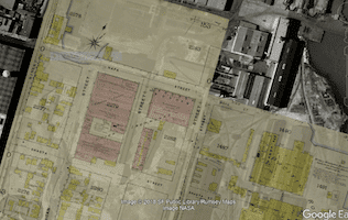
Kmz files containing georeferenced maps in the form of image overlays. These files open in Google Earth or in any other GIS application, but the map images are all georeferenced against the 1938 aerial imagery available in Google Earth.
Files open to display only an index of the contents, with all the map image content turned off. Expand the file's internal folder structure and toggle on the folder called "sheets" or "plates" to load the map images; then select that folder and apply opacity control to fade the map images against the background aerial imagery.
The images are large and performance will vary from machine to machine. If the images are not loading well, close Google Earth, relaunch the application, reopen the file, and load the images a few at a time by toggling on the individual images a few at a time; the fire insurance map images are organized into subfolders by the publisher's volume system, so toggling on those subfolders one at a time should give a similar result.

CA Board of Tide Land Commissioners maps (1869)
15 MB

fire insurance keymaps
54 MB

fire insurance maps - Civic Center (1886-1893)
17 MB

fire insurance maps - Civic Center (1899-1900)
16 MB

fire insurance maps - Civic Center (1905 corrections to 1899-1900)
17 MB

fire insurance maps (1913-1915)
30 MB

fire insurance maps - Potrero Hill (1886-1893)
9 MB

fire insurance maps - Potrero Hill (1905 corrections to 1899-1900)
42 MB

US Coast Survey maps (1853-1869)
70 MB